View image
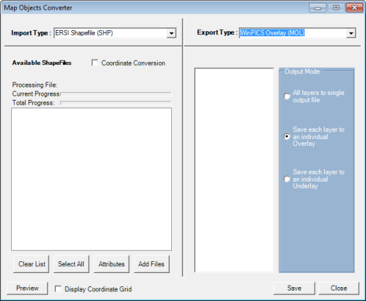
How to open the map objects converter dialog box
- Import Type = ESRI shapefile (SHP)
- Export Type = ProductName Overlay (MOL)
You have the following options for your ESRI shapefile import:
- Coordinate Conversion - Select to modify coordinate parameters.
- Clear List - Removes all objects from the list.
- Select All - Selects all objects to import.
- Attributes - Allows you to modify line color, width, fill and text size. Select a shapefile from the list and select Attributes. Modify the display attributes for the file and click <OK>. Select the file and click <Preview> to view the changes.
- Add Files - Allows you to browse for files from other directories.
- Preview - Used to view selected map objects before importing.
- Display Coordinate Grid - Adds a coordinate grid to the preview window.
- All Layers to single output file - Merges all layers into one and creates as a single overlay layer
- Save each layer to an individual Overlay - Each layer is saved as individual overlays.
- Save each layer to an individual Underlay - Each layer is saved as individual underlays.
What do you want to do?