From WinPICS, you can activate a dynamic form of WinPICS that enables you to temporarily integrate GeoVista's database. When you turn on VistaBridge, GeoVista will act as a server and instantly make all of its data sets available to WinPICS. This data from GeoVista isn't permanently loaded into WinPICS so it doesn't increase the size of your project. When you turn off VistaBridge, your data from GeoVista is no longer available to WinPICS.
Start VistaBridge from WinPICS
To activate VistaBridge and connect WinPICS to GeoVista, click  on the toolbar. The rest of the toolbar will become active and offers you the following options:

Option Description Display/toggle GeoVista layers 
Select any feature mode 
Select points mode 
Select lines mode 
Select regions mode 
Select wells from the map 
Query GeoVista database 
Show bubble map on wells
- When you're working with WinPICS in tandem with GeoVista, make sure to turn off the VistaBridge first by clicking again, then close WinPICS. If you close WinPICS without turning off the VistaBridge tool, then GeoVista will display an error and automatically close.
- VistaBridge will time out after an hour and a half of inactivity.
About GeoVista layers
When you activate VistaBridge, WinPICS temporarily adds GeoVista layers to the Layers tab of the Object Manager for you to use:
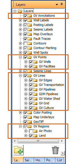
Select or clear the check box for each layer you want to hide or display in your WinPICS map. Since this is a dynamic VistaBridge connection, any changes you make to these layers in WinPICS, will be reflected in GeoVista. To learn more about interacting with different layers in the Layers tab,
- Since the GeoVista layers are temporary, and only available when you activate VistaBridge, changes that you make to the order or visibility of these layers are not permanently saved in your WinPICS project.