 View image
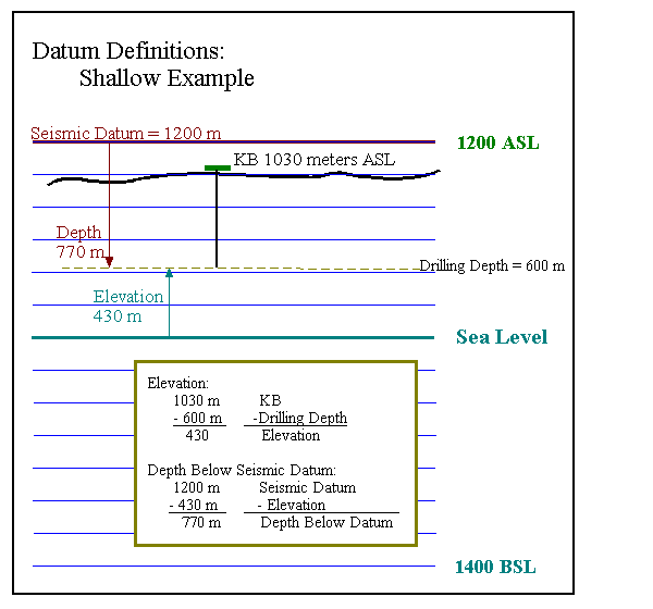
WinPICS will post your well tops and depth grids to your maps in elevation or depth below seismic datum.
WinPICS
Seismic is in the time domain. Tops and well information are in the depth domain. The elevation of the seismic datum ties seismic times to the depth values.
Use the Set Seismic Datum dialog box to set the elevation and velocity for your seismic datum.
The only relevant datum in time depth conversion is the seismic datum. To generate a velocity, we need to divide a distance by a time.
The distance is calculated as the distance between the elevation value of the point of interest (a top), and the elevation of the seismic datum.
The seismic datum is defined as time 0 for all seismic sections in the project. The time is calculated as the difference between the time of the horizon and time 0.
The Kelly Bushing (KB) datum measures well depth. Well depth is initially in measured death (MD). WinPICS
The drilling depth is TVD below KB.
If the well is vertical, then MD below KB is the same as TVD below KB.
To calculate the average velocity, WinPICS
The following images shows examples of how WinPICS
 View image
 View image
 View image

What do you want to do?