Open topic with navigation
Post
Grids
After you create
a grid, post the gridded surface as follows:
- From the menu select | data type (Time, Amplitude, Depth, Depth as Elevation, Interval Velocity, Average
Velocity, or User Defined).
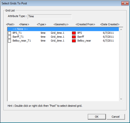
- A window will open containing a grid list of the
data type you have requested. Each grid is listed with its data type (attribute),
grid parameter filename, associated horizon name, and date that the grid
was created.
 View image

- Double click on the check box under the Post column next to the gridded horizon
you wish to post. An X will
appear in the box next to the selected grid, click <OK>.
Alternatively, click <Cancel> to
exit window without posting a grid.
- Multiple grids can be posted to a single basemap
by double clicking on more than one check box under the Post
column.
What do you want to do?
 View image
 View image